















Nepal flash flood exposes cascading risks to Himalayan communities, infrastructure
A suspected landslide-dam breach sent a destructive surge down the Budhi Gandaki River, washing away homes and damaging bridges and hydropower facilities as rescue teams searched for five missing people.
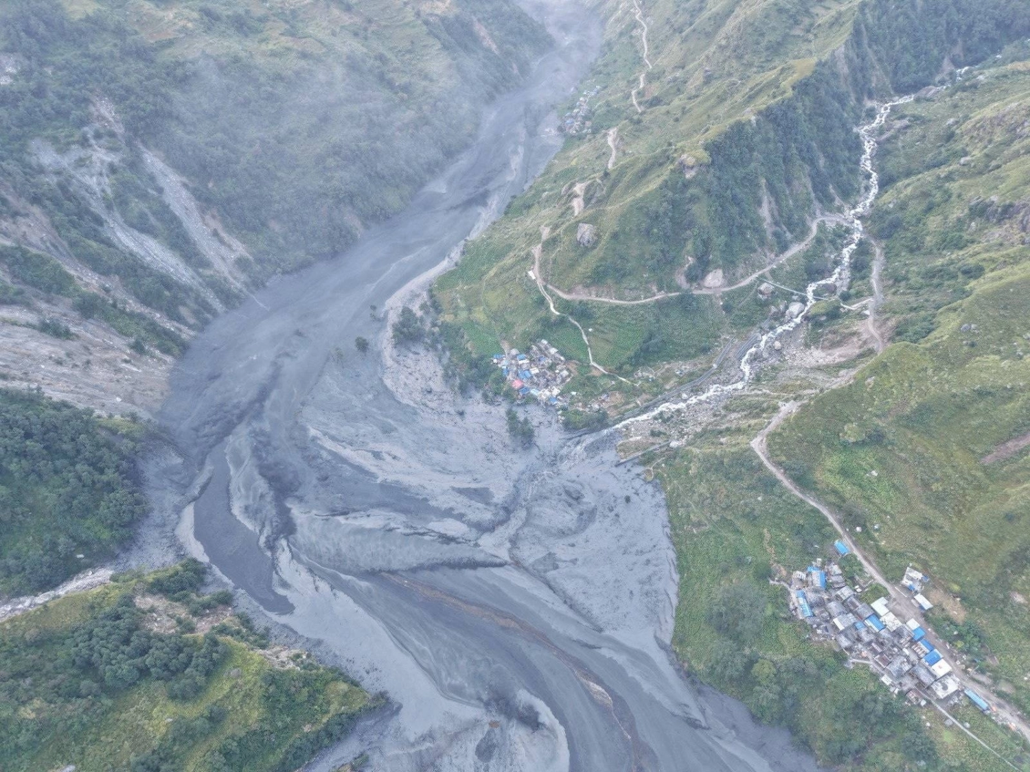
A flash flood in Nepal’s Gorkha district has exposed the vulnerability of Himalayan communities whose homes, transport links and energy infrastructure sit along steep river corridors. The surge on Sunday, 11 October, swept away dozens of houses, damaged bridges and hydropower facilities, and left at least five people missing. Emergency teams have been evacuating residents and searching for people cut off by the flooding.
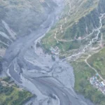
The immediate trigger appears to have been a landslide that temporarily blocked the Budhi Gandaki River before the barrier gave way. The International Centre for Integrated Mountain Development (ICIMOD) said preliminary information indicated that the breach released water, mud and sediment downstream. Its assessment also highlighted the potential for one mountain hazard to trigger another, multiplying the impact on settlements and infrastructure far from the original blockage.
The disaster is unfolding while Nepal continues to recover from a deadly flood disaster in August. But the two events have different reported triggers: the latest flood is associated with a suspected landslide-dammed river, whereas the August catastrophe was linked to a glacial collapse. Their proximity in time highlights the range of hazards confronting the Himalayas, not proof that one event directly caused the other.
Early assessments differed as officials worked to establish the full extent of the destruction. Reuters initially reported that about a dozen houses and two suspension bridges had been swept away, alongside damage to a hydroelectric project camp. The Associated Press subsequently reported that roughly three dozen houses and four bridges had been destroyed or damaged. By 12 October, figures carried by AFP through Bangladesh Sangbad Sangstha put the number of houses swept away at about 45, with three hydropower projects and four bridges damaged.
These figures should be read as evolving assessments rather than necessarily contradictory final counts. The affected area includes multiple settlements and infrastructure sites, and the extent of damage was still being assessed as rescue operations continued.
The National Disaster Risk Reduction and Management Authority reported five people missing. Reuters identified them as two women and three men, while the AP reported that military rescue teams were using helicopters and ground personnel to reach affected communities. The latest AFP report said at least 82 people, including nine foreign nationals, had been rescued; earlier reporting from the AP recorded lower rescue totals as operations progressed.
The sequence matters: rescue numbers and damage estimates can change as isolated settlements become accessible and officials receive new information. The immediate priority is to locate those missing, evacuate people at risk and establish which communities remain cut off.
A landslide-dammed river creates a temporary barrier of rock, soil and debris. Water continues accumulating behind it, and if the barrier fails, the stored water can rush downstream with little warning. The resulting flood may carry large quantities of sediment and debris, increasing its destructive force.
ICIMOD’s preliminary assessment placed the flood’s onset at around 4 am Nepal time on Sunday. It said warnings were issued for communities along the Budhi Gandaki, Trishuli and Narayani river systems as water levels fluctuated. The organisation also identified damage at the 341-megawatt Budhi Gandaki hydropower project site at Selleri, although the full extent of the losses remained under assessment.
The Radio Nepal report on ICIMOD’s assessment likewise described the suspected breach of a temporary landslide blockage and the risk to riverside settlements and infrastructure. The similarity between the accounts reflects their reliance on the same preliminary assessment, rather than constituting independent confirmation of every detail.
This distinction is important for interpreting early disaster reporting. The mechanism is plausible and supported by initial assessments, but a fuller investigation is needed to establish how the blockage formed, how it failed and whether monitoring could have provided additional warning.
The flood’s impact extends beyond destroyed homes. Bridges and river crossings are essential links for remote communities, and their loss can restrict access for rescue teams, relief supplies and medical assistance. Damage to electricity and communications infrastructure can further complicate evacuation and recovery.
Reporting by The Kathmandu Post described damage across settlements in Chumnubri and Dharche rural municipalities, with houses, bridges and infrastructure around a hydropower project affected. The newspaper’s account also showed how uncertainty over the precise scale of the destruction persisted while officials assessed damage across the affected area.
The energy implications need careful interpretation. Damage to a hydropower construction site or project camp does not automatically mean that an operating power station has stopped generating electricity. The extent of damage to each facility, its operational status and any resulting loss of generation must be established separately before the event’s effect on Nepal’s power supply can be quantified.
The flood also affected a region used by trekkers. The AP reported that foreign visitors were among those requiring rescue or facing disruption after trails and bridges were damaged. In mountain tourism areas, damaged access routes can strand visitors while also limiting residents’ access to markets, services and emergency support.
Nepal’s exposure to floods cannot be reduced to one explanation. Intense rainfall, unstable slopes, glacial and ice-related events, river blockages and the concentration of settlements and infrastructure along narrow valleys can interact in different ways. The latest flood is a reminder that hazardous conditions can develop suddenly, even when the immediate trigger differs from that of a previous disaster.
The August flood, associated with a glacial collapse near the Nepal-China border, killed more than 1,400 people according to figures cited in earlier reporting. The government subsequently shifted from the immediate search-and-rescue phase towards recovery, although the reported number of people missing and the final accounting of casualties have varied over time. Those figures should not be merged with the five people missing in the October incident.
ICIMOD’s analysis places particular emphasis on cascading hazards: a landslide can block a river, the resulting barrier can fail, and the flood can then damage settlements, bridges and essential services downstream. This means that monitoring only rainfall or only glacial lakes may leave other sources of sudden flooding insufficiently addressed.
The practical implications are clear. Risk assessments need to consider unstable slopes and river channels together, identify potential blockage points, and map settlements and infrastructure that could be exposed if a temporary dam collapses. Early-warning systems must also reach people who live far from major roads or communications networks.
Authorities have urged residents in vulnerable areas to move to safer locations, while rescue teams continue to assess the affected settlements. The immediate tasks are to account for missing people, provide shelter and essential supplies, and restore access where bridges and roads have been damaged.
The longer-term challenge is to turn the findings from this event into better preparedness. That includes systematic monitoring of landslide-prone river corridors, clearer evacuation plans, reliable communication channels and infrastructure planning that accounts for sudden, sediment-heavy floods. Hydropower and transport projects in mountainous terrain also need risk assessments that consider not only direct flooding but the possibility of upstream blockages and cascading failures.
The latest disaster does not establish that all Himalayan floods share a common cause, nor does it prove that every loss could have been prevented. It does show why emergency response alone is insufficient. In a region where a single slope failure can disrupt a river, destroy bridges and isolate communities, reducing future losses depends on understanding the entire chain of hazards—from the unstable hillside to the downstream settlement.
As the search for the missing continues, the central question is not only how much the flood destroyed, but whether better monitoring, warning and infrastructure planning can reduce the consequences of the next sudden river surge.
